Photo by Anthony Butzek
The Intertwine Regional Habitat Connectivity Working Group (RHCWG) formed in 2016 to map the region’s remaining habitat connectivity, improve conservation outcomes over existing conditions, support enhanced stewardship and public education. The RHCWG is a partnership of ecologists, land use and transportation planners, community-based organizations, and individuals who value and care for the interconnected habitats that thread through our urban and rural landscapes. The group includes more than 100 members over 40 public agencies, academic institutions, parks districts, non-profits, consultants and watershed councils, plus nearly two dozen community members with high interest in this work.
Habitat connectivity was one of the top priorities identified in the Portland-Vancouver Regional Conservation Strategy. The RHCWG is working to better integrate habitat connectivity into regional planning and project implementation related to urban development, transportation, utilities, as well as other human infrastructure and investment. The RHCWG is refining regional habitat corridor maps and developing best management practices to improve habitat connectivity over the long-term for the Portland metropolitan region. Through improved habitat connectivity, native fish and wildlife species will be better able to move and respond to climate change.
Climate change, community growth, and development potentially jeopardize the region’s relatively healthy and connected habitats. Through better coordination and collective action, the RHCWG aims to identify, protect and restore habitat connectivity. We will educate and inspire communities to take proactive steps to preserve and reconnect habitats where possible. Join us!
For an understanding of ‘The Intertwine’ region and RCS planning area, see the interactive map here.
What is habitat connectivity, and why does it matter?
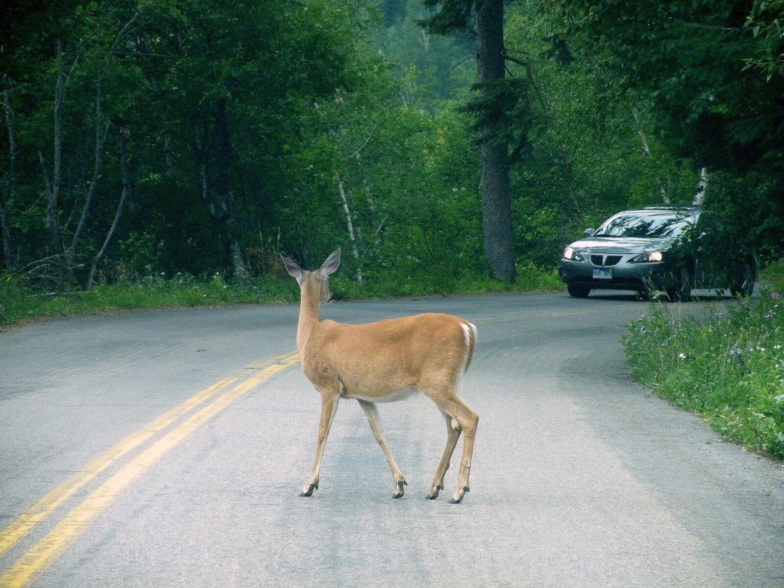
The greater Portland-Vancouver region is home to at least 338 species of vertebrate wildlife species, 72 fish species, and many more plant and fungi species. Habitat connectivity is a measure of how easy it is for individual organisms to move between patches of suitable habitat to reach the desired destination. The survival of these species depends on the amount of remaining habitat, quality of that habitat, and the interconnectedness of those habitat patches so that species can cross less suitable habitats to carry out essential life functions such as dispersing, migrating, finding a mate, or overwintering.
Good habitat connectivity generally leads to healthy ecosystems by increasing biodiversity, migration, post-natal dispersal and genetic flow between populations. In isolated habitats, if for some reason a species blinks out due to disease or predation, there is no way for that species to recolonize said patch and the habitat patches will lose species over time. Bird and small mammal studies have demonstrated this effect in the Portland area.
Habitat connectivity can be difficult or impossible to regain after urbanization, yet it is critically important to the region’s wildlife. Habitat loss and fragmentation have partially or fully isolated many of the remaining habitat patches in our region, and the developed areas between patches may be too hostile for many species to navigate. Maintaining and improving connectivity will help retain and increase the region’s biodiversity by allowing species to move as needed to fulfill their life history requirements.
Strategic Action Plan
In February 2024, RHCWG finalized a strategic action plan (SAP) to guide its work over the next 5 to 10 years. We worked with an equity consultant to conduct an equity audit of our planning process and procedures around Justice, Equity, Diversity and Inclusion (JEDI).
The Habitat Connectivity Toolkit
After several years’ efforts, the RHCWG recently completed the creation of a Habitat Connectivity Toolkit. The toolkit guidebook provides instructions on modeling, habitat assessment, permeability (barrier) assessments, and Individual species scorecards. The surrogate species’ computer modeling techniques are intended to be replicable for other species in different geographies. This also allows the RHCWG to adjust or add surrogate species’ models as we learn more about a species’ needs or presence in our region.
Many species’ distributions will change over the coming decades, therefore the ability to adjust existing and create new models is especially important in light of climate change. Through improved habitat connectivity, native fish and wildlife species will be better able to move, respond to climate change, and persist over time.
In June 2021 the habitat and connectivity models underwent one final peer review by local species experts and some adjustments were made. Metro will develop an online-viewing tool and make the dataset available by the end of 2021.
Justice, Equity, Diversity and Inclusion (JEDI) in our work
Habitat connectivity concerns also impact human health and well-being. In 2020, the RHCWG decided to pause our strategic action planning process and work to incorporate a Justice, Equity, Diversity, and Inclusion (JEDI) framework into the plan. The steering committee created a JEDI committee and recruited members to start the work. The JEDI committee worked with Knot Design and Multicultural Collaborative to perform an equity audit of the strategic action plan. The equity committee incorporated the recommendations from the equity audit report into the Strategic Action Plan to create an inclusive space for historically underrepresented communities to join future planning processes.
PARTNERS
Bird Alliance of Oregon
City of Hillsboro
City of Milwaukie
City of Portland Bureau of Environmental Services
City of Portland Parks and Recreation
City of Wilsonville
Clackamas County Land Use and Transportation
Clean Water Services
Columbia Land Trust
Columbia Slough Watershed Council
Forest Park Conservancy
Friends of Forest Park
Friends of Tryon Creek
Knot Design
Metro
Multnomah County Transportation Department
North Clackamas Parks & Recreation District
Northwest Power and Conservation Council
Oregon Department of Fish and Wildlife
Oregon Department of Transportation
Portland State University
Samara Group
The Xerces Society
Tualatin Hills Park & Recreation District
Urban Greenspaces Institute
U.S. Fish and Wildlife Service
Washington County Land Use and Transportation
West Multnomah Soil & Water Conservation District
Other accomplishments to date
In addition to creating the Statement of Purpose, the RHCWG has accomplished a number of tasks:
Habitat connectivity toolkit: The RHCWG has been active since 2016, but prior to that Metro was working with PSU to develop a connectivity toolkit for a suite of surrogate species. After a series of peer reviews and adjustments, the Habitat Connectivity Toolkit was completed in June 2021.
Earlier drafts of the connectivity toolkit were used to inform Metro’s 2018 natural areas bond target area selection. The final models are being used to inform the target areas’ ecological assessments.
Field methods: The RHCWG has developed field-based methods to assess habitat and potential barriers. Each surrogate species has its own score-card based on field results.
Field research:
PSU graduate student Natalie Rogers (now at City of Milwaukie) tested three methods for assessing connectivity in the field. These included the Connectivity Toolkit’s field-based methods, private landowner interviews, and Circuitscape. The Connectivity Toolkit’s methods proved to be most useful in that study area, located near Smith and Bybee Wetlands.
PSU graduate student Amanda Temple worked with a team to radio-backpack some Northern red-legged frogs in the Harborton Frog Shuttle area to determine how far the frogs moved from their breeding ponds to nearby upland forest. The distances were larger than indicated in the literature, resulting in changes to this species’ habitat and connectivity models.
Samara Group field-tested the scoring methodologies to determine whether the models properly scored some of the poorest habitats; the findings were reassuring and no changes to the methods were needed at that time
Resources
Related tools and efforts
Metro’s climate and environment mapping tools
Climate Adaption Planning Analytics (CAPA) heat resiliency
Landscape Planning For Washington’s Wildlife: Managing For Biodiversity In Developing Areas
Oregon Conservation Strategy
We want to hear from you!
For more information, send us an email to theresa@theintertwine.org.