Have you ever come to a fork in a trail and not known which way to go?
Well, that’s what was happening to a lot of people on the Fanno Creek Trail. As the trail winds its way through several cities, there are places where it suddenly splits into different paths that either loop back together again or spur into the local road network.
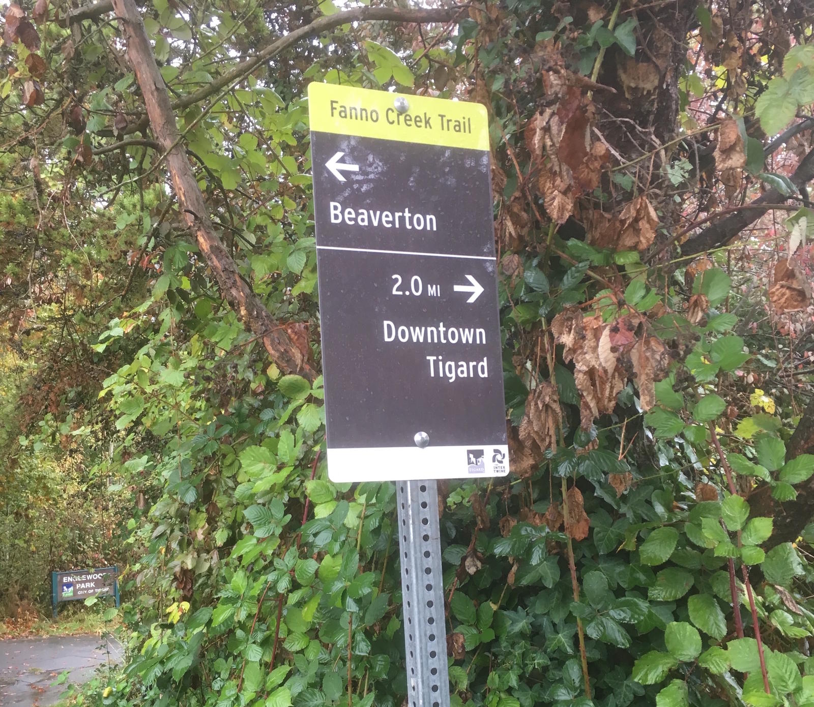
But with no signs to point people in the right direction, local parks departments were getting a lot of calls from lost and confused people.
As the regulatory agency overseeing urban growth in the region, it should come as no surprise that Metro is not universally loved by the various local cities that it regulates. So you can imagine my surprise when local city staff suggested that Metro tell them what to do.
They needed a set of signs that would help people get around on regional trails. But since regional trails don’t start and stop at city boundaries, the sign design would need to be coordinated between all the different cities. So, in Fall of 2011, they turned to Metro for guidance.
I was flattered that the cities came to Metro for help. After all, Metro has been working for decades to help local cities plan and build a 1,000-mile connected network of regional trails. I jumped at the chance to create a set of signs that would not only help people find their way, but also elevate the status and visibility of regional trails as the backbone of The Intertwine active transportation network.
We got right to work. We hired sign consultant Mayer/Reed, brought a bunch of trail agencies together, and jointly came up with the Intertwine Regional Trails Signage Guidelines. The guidelines address three goals:
- They make it easier for people to use trails to get where they need to go;
- They give a common identity to our premier biking and walking routes, similar to the ubiquitous red and blue shield on Interstate highways; and
- They raise awareness of The Intertwine.
By incorporating eye-catching colors with conventional materials, the signs combine The Intertwine’s distinctive brand with a simple, cost-effective approach. And by leaving space for local agency logos, the guidelines strike a balance between preserving each city’s identity and providing a user-friendly uniform look and feel from one city to the next.
Before finalizing the design, we put up 10 test signs along the Fanno Creek Trail in early 2012 and asked people what they thought. About 100 trail users weighed in over a 30-day test period, and the overwhelming consensus was that the signs were a big hit.
“For someone like me who is severely directionally impaired," one person commented, "signs are a lifeline! They’re great!”
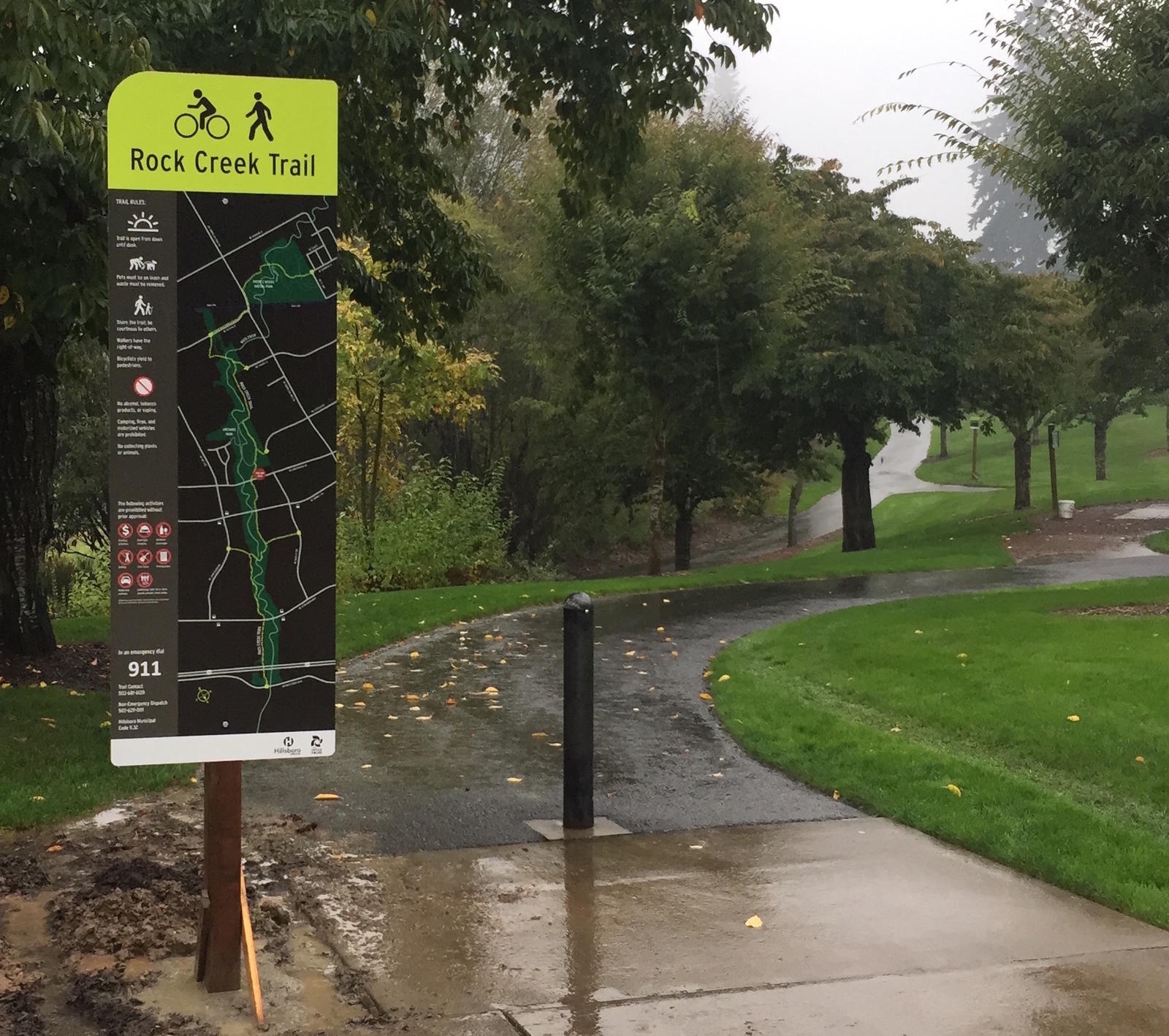
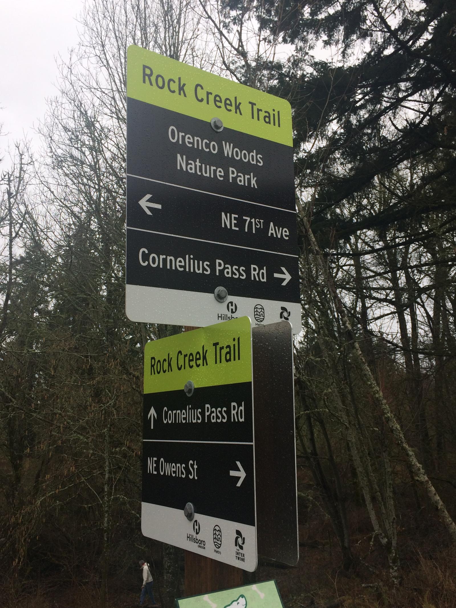
With the new guidelines in hand, the race was on to put signs on as many of the region’s trails as we could. As is so often the case with regional trails, Tualatin Hills Park & Recreation District was first out of the gate and off to an early lead. THPRD wasted no time installing new Intertwine signs on its three biggest regional trails – the Westside, Rock Creek and Fanno Creek trails.
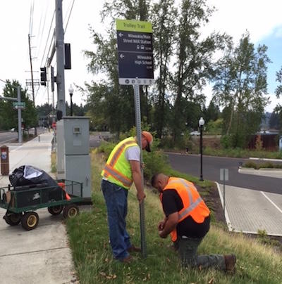
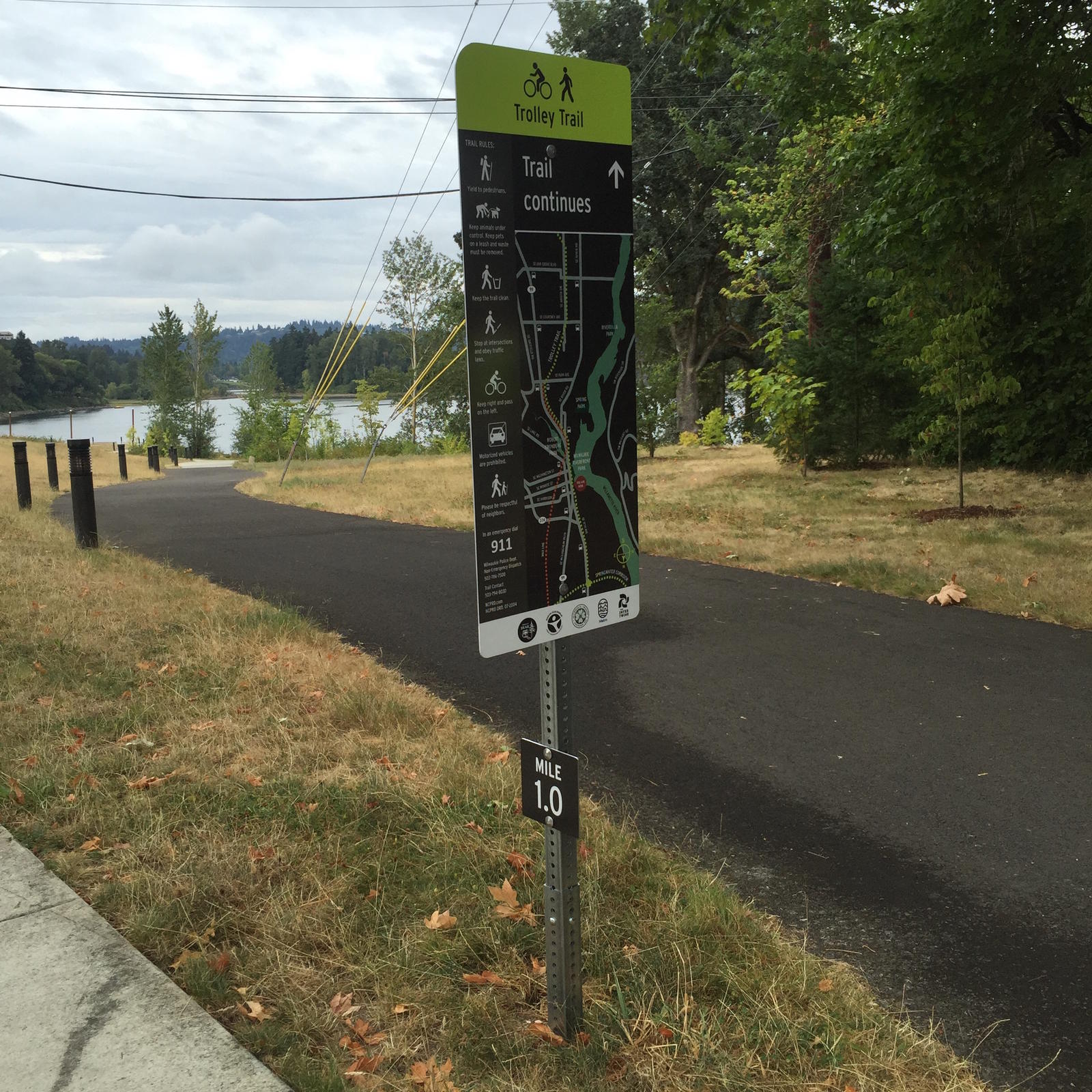
More cities followed suit. For its part, Metro installed about 400 more signs on four regional trails spanning 10 miles and six cities, including some of the region’s newest and most iconic trails, such as the Tualatin River Greenway, Orenco Woods Nature Park and the Trolley Trail.
Anyone who’s familiar with designing and installing wayfinding signs knows that it’s a lot harder than it seems. At about $75 apiece, manufacturing the signs was pretty affordable. But add in planning, design and installation costs, and each sign ends up costing more like $450.
Why so much? For one thing, no two signs are alike. Each one is tailored to its specific location, with things like arrows, distances and destinations changing from one sign to the next. Many of the signs include customized maps, each requiring a lot of time and attention to detail.
Time and money weren’t the only challenges. One city purchased the wrong set of fonts, so their signs look slightly different than the others. Another city installed the signs in a few places, then abruptly changed course and started using a totally different design.
We also learned that parks maintenance crews don’t like having to dodge sign posts with their lawn mowers, which limits our installation options. The trails in Rood Bridge Park that are inundated by the Tualatin River for several weeks each year required their own set of creative solutions.
Despite the challenges, Metro and its partners are forging ahead. We’re incorporating our lessons learned into an updated version of the manual, to be released this summer. And we continue adding more signs to more trails. Up next is the Marine Drive Trail. Stay tuned!