Pop quiz. Any guess which of our regional trails saw the most pedestrian, cycling and other non-motorized traffic last year? Read on for the answer, and to find out how we know.
This year marks the 11th annual Regional Trail Count held on The Intertwine network of trails. As this effort enters a second decade of counting regional trail users, let’s take a closer look at what the count is, how it contributes to a national data collection and analysis effort, the counting methodology, some important findings, and how you can participate this September.
What is it?
Each year, Metro partners with cities, counties, parks providers and transportation agencies within the region to conduct counts on regional trails running through their jurisdictions. The counts help agencies estimate trail demand and activity to understand where regional investments are needed to improve and expand the regional trail network.
Locally, Metro uses the data collected to:
- Better understand the needs of the regional trail network
- Understand how to enhance the use of trails
- Secure grant funding to increase opportunities and better conditions for trail users
Part of a national effort
The regional trail counts are part of a national effort by the National Bicycle and Pedestrian Documentation Project (NBPD) to count cyclists, walkers and others (wheelchairs, skateboards, etc.) nationwide. This is needed because, according to the NBPD website, “One of the greatest challenges facing the bicycle and pedestrian field is the lack of documentation on usage and demand.”
By showing accurate and consistent demand and usage figures for cycling, walking, etc. on non-motorized transportation networks (including regional trails), the positive benefits of these modes can be used to advocate for further investments in these systems, thus growing them over time.
How it works
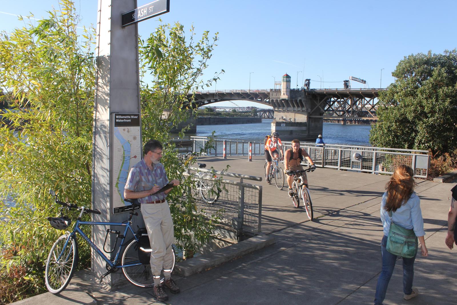
Counts are conducted over a five-day period in mid-September. Volunteers are recruited and are assigned to count from 5 to 7 p.m. on one of the weekdays and from 9 to 11 a.m. on a weekend day. These days and times are chosen because it’s believed peak trail usage occurs then. The two-hour blocks are further broken into 15-minute intervals to give more nuance to the data. This helps trail managers know when usage peaks and when it is near normal background levels.
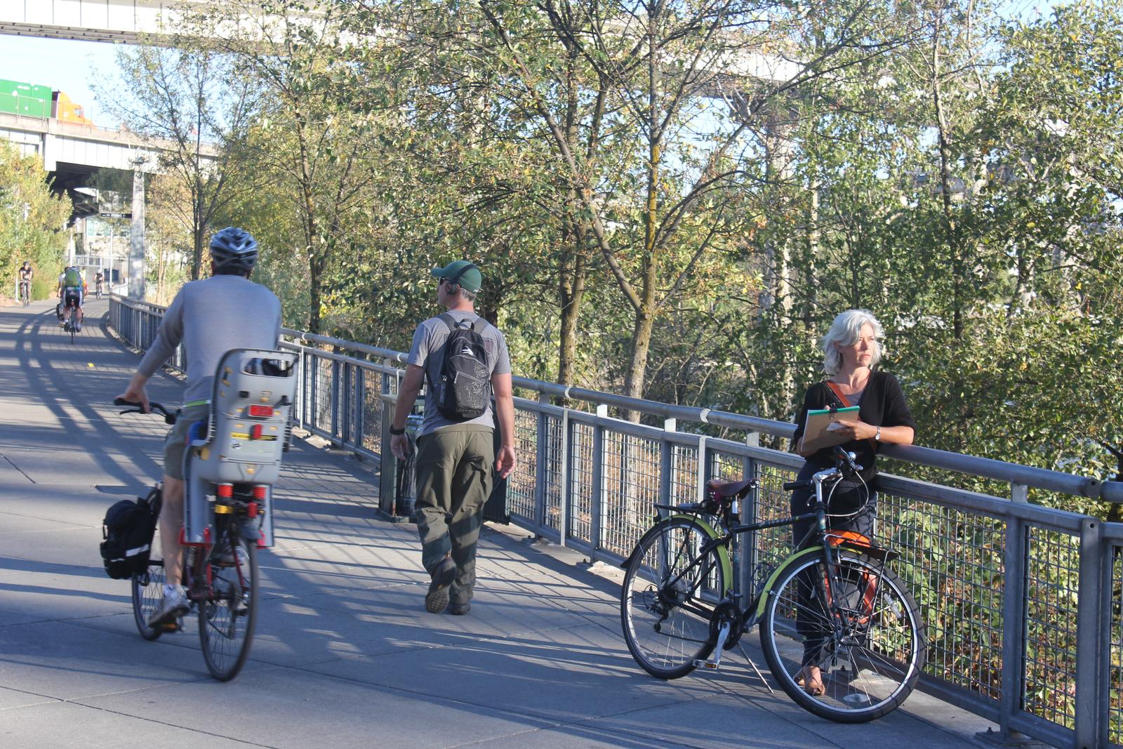
To count users, an imaginary line called a "screenline" is placed on the trail segment being counted, and the gender and mode of travel for each user who crosses the screenline are counted. The different modes counted are bicycle, pedestrian, wheelchair and "other" (skateboards, rollerblades, scooters, etc.).
Metro and participating agencies also conduct intercept surveys of regional trail users to find out what activities people do on the trails, reasons for using the trails, duration and frequency of use, and demographic information.
Volunteers count using either an online real-time counter with their smart phones, or by making tally marks on a paper form. Data from both methods is entered into a central database at Metro, where it is published on Metro’s website. Once entered, the two-hour count data can be extrapolated using NBPD spreadsheets to show daily, weekly, monthly and yearly estimates of trail use.
Work is underway to share the full trail count data with the public in a visually attractive and intuitive way so that community members can learn more about trail use in their own backyards and advocate for investments in them.
What we've learned
A few numbers stand out that show the growth of the regional trail network over the 11 years that the counts have been happening.
- The program is growing bigger every year. In 2008, 61 volunteers counted 11,433 users on 40 sites throughout the region. Last year, 293 volunteers counted 45,002 users on 125 sites throughout the region.
- Six of 11 trail count partner agencies surveyed said that they use count data directly in grant applications related to trails, and 10 of the 11 said they use data to show their respective city councils, boards or senior staff that trails are used, desired and needed.
- In 2009, 35 percent of trail users counted were women, while in 2017, 42 percent of trail users were women. Women are often considered an indicator of the health of the active transportation network, as research shows that women tend to place a higher value on safety than men. A 7 percent increase of female users is an important signal that the regional trail network is increasingly attracting women trail users and is perceived as safe.
The following sites had the most trail users counted in 2017. They are all in Portland, with the exception of #9 in Vancouver, Washington.
- Steel Bridge, lower deck -- 5717 counted
- Hawthorne Bridge, north side -- 2251
- Hawthorne Bridge, south side -- 1412
- Waterfront Park Trail at SW Morrison St -- 1099
- Eastbank Esplanade at OMSI -- 1075
- Broadway Bridge at Lovejoy ramp intersection -- 1064
- SW Willamette Greenway at SW Harbor Way -- 956
- Eastbank Esplanade at intersection south of Burnside Bridge -- 943
Columbia River Renaissance Trail, just east of second parking lot -- 893
- Tilikum Crossing, north side -- 795
Help us count!
The 2018 counts are happening Sept. 11, 12 and 13 and Sept. 15 and 16 -- and we are actively recruiting trail count volunteers right now!
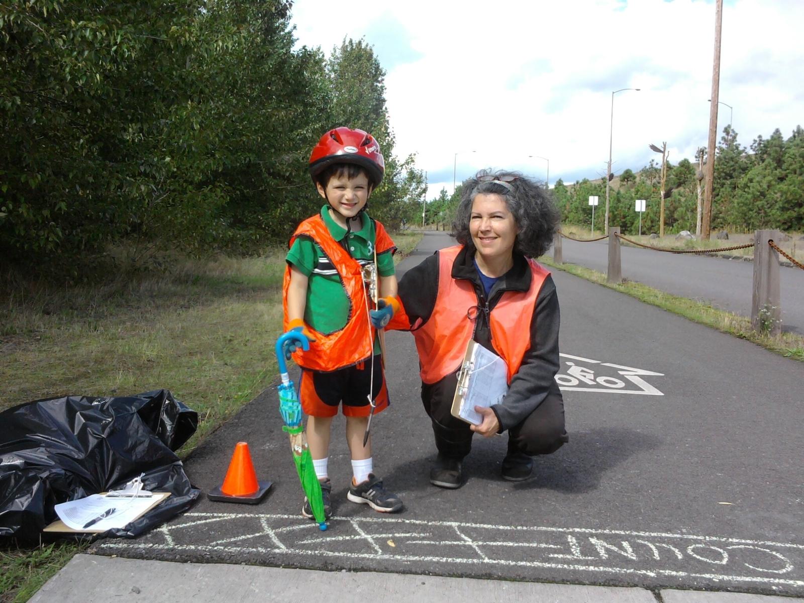
140 sites are on the list to be counted this year, so with your help we hope to count even more people than in years past. Volunteering is fun and easy, and you often get to count along trails in beautiful parts of the region (some of which you may not have known existed).
To get involved, visit Metro’s trail count volunteer webpage and scan the map to select the site(s) where you would like to count. Then, click the circle representing the count location to see the site ID number, trail name and location. Next, send this information to the local agency partner listed and tell them that you want to volunteer. They will follow up with you with a site assignment, send the materials you need to count, and point you toward training where you can learn how to count.
If you just want to count and don't care what trail it is, scan the list of count partners below the map and contact the city or agency you want to count with.
Once you are signed up, attend one of our volunteer training sessions at Metro on August 29 at either 4 to 5 p.m. or 5:30 to 6:30 p.m. to learn more about the specifics of how to conduct the counts. Please click the links to RSVP for the training of your choice.
Thanks for reading, and see you on the trails!